Breez by Danube Properties Location Map
Discover the prime location and explore nearby attractions, connectivity, and convenience
Location Research Guide
Discover the prime location and explore nearby attractions, connectivity, and convenience
Location Research Guide
View Breez by Danube Properties location map in UAE, nearby landmarks, transport links, and lifestyle access to evaluate convenience and investment potential.
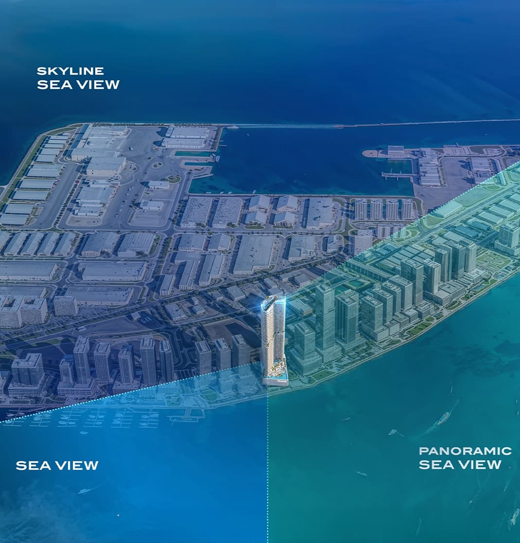
Dubai Maritime City is one of the emirate's most strategically conceived waterfront districts. Positioned between Port Rashid and the historical core of Dubai, it is being developed into a self-sufficient coastal community blending residential towers, marina facilities, a cruise terminal, retail promenades, dining destinations, and leisure hubs. The district offers something rare in Dubai real estate: genuine sea-facing living without the premium distance from the city's business and cultural centres. Connectivity Breez benefits from excellent road access via Sheikh Zayed Road and Al Mina Road, placing it within comfortable driving distance of Dubai's principal commercial and leisure destinations. An upcoming metro station in the Dubai Maritime City area will further transform the connectivity proposition for residents, making car-free commuting a realistic option.
Major highways & metro
City center access
Retail & dining nearby
Schools & universities
The location map helps evaluate commute time, access roads, public transport, and nearby lifestyle infrastructure before making a buying decision.
Focus on schools, hospitals, retail, business hubs, and major road links to assess daily convenience and long-term rental or resale demand.
Properties in well-connected areas with strong amenities typically attract better demand, supporting occupancy and long-term price resilience.
Explore the convenience of having essential amenities and attractions within easy reach
2 minutes
3 minutes
8 minutes
8 minutes
8 minutes
10 minutes
15 minutes