
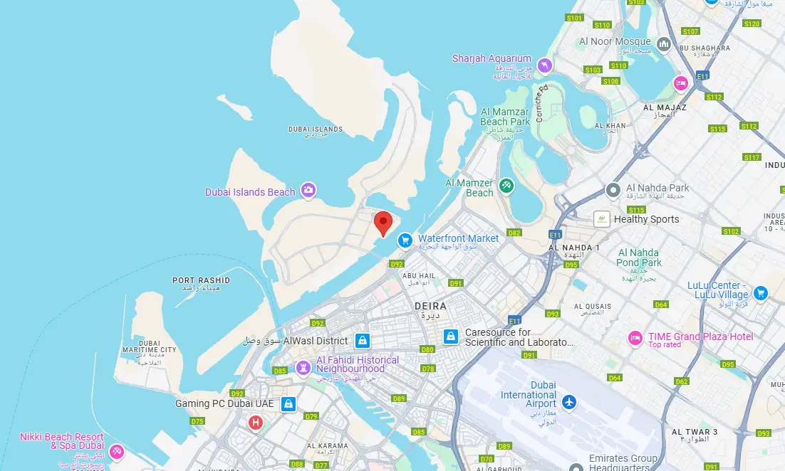
Azizi Wasel at Dubai Islands Location Map
Discover the prime location and explore nearby attractions, connectivity, and convenience
Location Research Guide

Discover the prime location and explore nearby attractions, connectivity, and convenience
Location Research Guide
View Azizi Wasel at Dubai Islands location map in UAE, nearby landmarks, transport links, and lifestyle access to evaluate convenience and investment potential.
Residents of Azizi Wasel enjoy unparalleled convenience and seamless connectivity throughout Dubai thanks to its location on the Dubai Islands. The neighborhood, which is located in the well-known Deira District, has easy access to major highways, Downtown Dubai, and Dubai International Airport. It combines waterfront peace with city accessibility, surrounded by immaculate beaches, recreational opportunities, shopping centers, and historical sites. Because of its strategic location, it is perfect for investors seeking robust growth potential as well as end users seeking comfort in their lifestyle.
Major highways & metro
City center access
Retail & dining nearby
Schools & universities
The location map helps evaluate commute time, access roads, public transport, and nearby lifestyle infrastructure before making a buying decision.
Focus on schools, hospitals, retail, business hubs, and major road links to assess daily convenience and long-term rental or resale demand.
Properties in well-connected areas with strong amenities typically attract better demand, supporting occupancy and long-term price resilience.
Explore the convenience of having essential amenities and attractions within easy reach
15 Minutes
20 Minutes
25 Minutes
5 Minutes Walk